


The National Weather Service has a Flood Watch for all of Los Angeles County today, Thursday, Nov. 19, until 6 PM, and a High Surf Advisory for LA County beaches and the Malibu Coast until 9 AM Friday, Nov. 20.
The NWS Los Angeles/Oxnard office expects rain of up to 1 inch per hour, mainly in the mountains, and breaking waves of 6 to 9 feet with dangerous rip currents.
Here is what you need to know before you head out:
Flood Watch: rain, roads and burn scars

The watch covers Downtown LA, the San Fernando Valley, the San Gabriel Valley, Santa Monica and Long Beach.
The NWS expects the front to reach LA County between 9 AM and noon, and flash flood warnings have already been issued. Forecasters say the heaviest rain rates will fall in the mountains.
Rain totals of 1 to 3 inches are likely in coastal and foothill areas, and 2 to 5 inches on the coastal slopes. The NWS lists flooded roads and low-lying areas, heavy flows in creeks and canyons, rockslides, and mudslides and debris flows in recent burn scars as possible impacts.
If your route crosses a burn-scar area, check conditions before you leave and allow extra time.
Southerly winds of 35 to 50 mph are also in the forecast. Wind advisories stay in effect in parts of the region until 7 to 9 AM.
There is a 20 percent chance of thunderstorms, with the best odds in the LA Basin later this morning. Highs will reach only the mid 60s.
High Surf Advisory: what the NWS advises at the beach
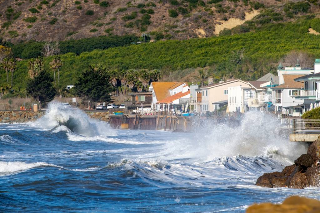
The advisory began at 6 AM Thursday and covers the Malibu Coast and all Los Angeles County beaches. Dangerous beach conditions are expected to peak today.
- Stay out of the water, or stay near an occupied lifeguard tower.
- Stay off rock jetties. Large breaking waves can wash people off beaches and rocks and capsize small boats near shore.
- Expect minor coastal flooding near the early morning high tide. Seawater may pool over low-lying beaches, walkways and parking lots, and beach erosion is possible. The NWS does not expect significant damage.
Forecasters also advise checking later forecasts and watching for possible Flood Warnings.
What comes next
Showers will likely linger into Friday, with winds shifting to the northwest and cool, blustery weather. Ocean conditions should improve through Friday and stay relatively mild on Saturday.
Friday and Saturday are expected to be dry, with Saturday sunny. A 20 to 30 percent chance of light rain returns Sunday, with less than 0.2 inches expected.
The calm will not last at the coast. The NWS Los Angeles/Oxnard office expects extremely high tides, likely record-breaking, from Tuesday, Nov. 24, through Thanksgiving Day. Additional swells could add elevated to high surf.
Forecasters say that combination is likely to cause at least widespread moderate coastal flooding on all coasts, with potentially significant impacts if a larger swell arrives during the highest tides. Thanksgiving itself looks dry.
If you plan a beach walk or a drive along the coast this holiday week, check the latest NWS forecast the day before you go.
For more, follow us on Facebook, Instagram, TikTok, and now WhatsApp!
