

L.A.’s wide open roads beckon, offering a chance to leave the world behind and uncover something new. Whether you’re cruising down iconic boulevards lined with towering palms, marveling at neon-soaked streets, or letting the salty air breeze through your hair along the coast, your in-car adventure awaits. Discover the Best Drives in L.A. with picturesque beaches, dramatic cliffs, and rolling hills covered with wildflowers, for a truly unforgettable experience.
1. Mulholland Drive
-

Credit: Cedric Letsch via Unsplash.

Winding its way through the foothills of the Santa Monica Mountains, Mulholland Drive stands out as one of Los Angeles’ most iconic and cinematic roads, providing the best views in L.A by car Its fame isn’t just due to its appearances on the silver screen and in many of our favorite songs about L.A., but also its breathtaking vistas of the San Fernando Valley.
With its blend of Hollywood glamour, Mulholland Drive is an outdoors movie location serving for both thrilling car chases (albeit staged) and romantic outings, making it no surprise that David Lynch chose it as the centerpiece for his neo-noir masterpiece. Driving through Mulholland will allow you to soak in panoramic views from various overlooks like the Hollywood Hills, the Getty Center, Runyon Canyon Park, and Griffith Park.
📍Itinerary
- Starting point: Intersection of Mulholland Drive and Laurel Canyon Blvd Los Angeles, CA 90046
- End point: Intersection of Mulholland Drive and Sepulveda Blvd Los Angeles, CA 90049
🚗 Distance: 9-10 miles
2. Windsor Boulevard
-

Credit: Roberto Nickson via Unsplash.

At times, you simply crave that quintessential L.A. scenery, and nothing screams it louder than this palm-lined boulevard offering a glimpse of the Hollywood Sign. This drive, it’s the epitome of Los Angeles and is only a few blocks long.
If you’re after that coveted snapshot with the sign, be sure to make a stop between 4th and 5th streets on Windsor Blvd. near Hancock Park. Undoubtedly, this route stands out as one of the most iconic experiences in the city, making it a must-see on any list of scenic drives in Los Angeles.
📍Itinerary
- Starting point: Windsor Blvd & Wilshire Blvd, Los Angeles, CA 90010
- End point: S Windsor Blvd & W 3rd St, Los Angeles, CA 90004
🚗 Distance: 2 miles
3. Griffith Park
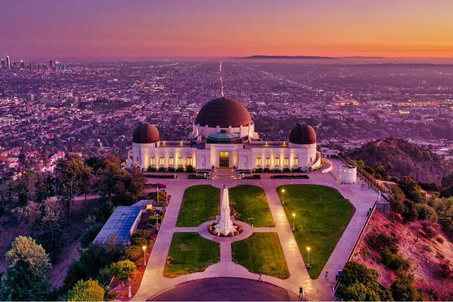
Journey through the scenic drives in Los Angeles where city meets wilderness around Griffith Park. Begin on Vermont Avenue, passing private estates and the Greek Theatre, then climb through a tunnel towards the Observatory.
Descend and enjoy twinkly city vistas before winding through Western Canyon Road and onto Fern Dell, a rustic evergreen-lined street. Plan for weekday drives to avoid weekend and event traffic.
📍Itinerary
- Starting point: 2200 N Vermont Ave, Los Angeles, CA 90027
- End point: Fern Dell Nature Trail, Fern Dell Dr, Los Angeles, CA 90027
🚗 Distance: 3.5 miles
4. Pacific Coast Highway (PCH) from Malibu to Neptune’s Net
-

Credit: Kyle Cottrel via Unsplash.
This iconic coastal drive from Manhattan Beach to Neptune’s Net ventures into Los Angeles County, making it an essential addition to any list of scenic drives in Los Angeles. Along this route, you’ll experience a quintessential journey, tracing the shoreline with breathtaking sunset ocean vistas on one side and impressive cliffs adorned with mansions on the other.
Sun-soaked bluffs provide ample opportunities for stops, including renowned spots like Leo Carrillo State Park and Zuma Beach. Conclude your journey by parking off in Manhattan Beach, where you can savor a classic California sunset amidst palm trees and vintage cars.
📍Itinerary
- Starting point: Manhattan Beach, California 90266
- End point: Neptune’s Net, 42505 CA-1, Malibu, CA 90265
🚗 Distance: 35 miles
5. Palos Verdes Estates to San Pedro
-

Credit: Derek Liang via Unsplash.

Experience this scenic route from Palos Verdes Estates to San Pedro along Palos Verdes Dr S, a quintessential journey showcasing the stunning landscapes of Los Angeles. Amidst the breathtaking natural beauty, including rugged cliffsides and potential whale sightings near Point Vicente Lighthouse, keeping your eyes on the road becomes a delightful challenge.
Upon arrival in San Pedro, explore the area’s iconic landmarks on foot, such as Angel’s Gate Park. Here, you’ll discover treasures like the ornate Korean Friendship Bell and a basketball court seemingly stretching into the ocean. This drive offers an unforgettable experience along one of the most captivating scenic routes in Los Angeles.
📍Driving itinerary
- Starting point: Palos Verdes Dr S, CA 90275
- End point: Point Fermin Park, San Pedro, CA 90731
🚗 Distance: 5.9 miles
6. White Point to Royal Palms Park
-

Credit: @districtvsion via Instagram.

One of Los Angeles’ most scenic drives along W Paseo Del Mar and Kay Fiorentino Drive to White Point Park at sunset. Witness a breathtaking sight: parked cars lining up to admire the cotton candy skies over the Pacific Ocean.
Turn right into the Royal Palms parking area for a bustling scene of surfers or turn left towards White Point for scuba divers and tide pool explorers. Relax at picnic tables atop the bluff, marveling at remnants of a 1920s hot spring resort.
📍Itinerary
- Starting point: W Paseo Del Mar, Los Angeles, CA
- End point: Royal Palms Beach Park, Los Angeles, CA 90732
🚗 Distance: 2.6 miles
7. Los Angeles Crest Highway to Mount Wilson Observatory

Undoubtedly, the coastal views in the area are stunning, but if you’re craving a truly unique experience, this scenic drive in Los Angeles from Crest Highway to the Mount Wilson Observatory awaits.
As you navigate the winding road, you’ll be treated to breathtaking aerial vistas of the Angeles National Forest. Once you’ve completed the ascent through the mountainous terrain, immerse yourself in the serene ambiance of the observatory’s vaulted dome, where you can enjoy captivating concerts.
📍Itinerary
- Starting point: Angeles Crest Scenic Bywy, California
- End point: Mt Wilson, California
🚗 Distance: 43 miles
8. Playa Del Rey To Manhattan Beach
-

Credit: @scottalexmills via Instagram.

Experience the stunning coastal scenery of Los Angeles with a scenic drive from Playa del Rey to Manhattan Beach. Start your journey at Culver Blvd in Playa del Rey and follow Vista del Mar southward, hugging the coastline.
Along this route, you’ll be treated to breathtaking views of the Pacific Ocean, passing by Dockweiler State Beach and El Segundo Beach. Take your time to soak in the beauty of the coastal landscapes and enjoy the serene ambiance of this picturesque drive in Los Angeles.
📍Itinerary
- Starting point: Culver Blvd & Pershing Dr, Los Angeles, CA 90293
- End point: Manhattan Beach, California 90266
🚗 Distance: 6.4 miles
9. Wilshire Boulevard
-

Credit: Joe Byrnes via Unsplash.

Travel along one of the city’s scenic drives on Wilshire Boulevard, offering a swift tour of essential attractions and picturesque vistas.
Begin near Koreatown and head west as you go through the LACMA’s iconic “Urban Light” installation, as you get closure to the cinematic area of Beverly Hills. Admire historic landmarks and modern architecture while traversing this iconic route, experiencing the city’s diverse cultural tapestry firsthand in this scenic drive in Los Angeles.
📍Itinerary
- Starting point: S Vermont Ave & Wilshire Blvd, Los Angeles, CA 9005
- End point: Via Rodeo Dr & Wilshire Blvd, Beverly Hills, CA 90212
🚗 Distance: 3.5 miles
10. Santa Monica to Malibu on the PCH
-

Credit: Ildan Suleimanov via Unsplash.

Discover one of the most captivating scenic drives in Los Angeles, starting from the southern end of Interstate 10. Begin your journey by heading northward along the legendary Pacific Coast Highway (PCH) toward Malibu.
Along this iconic route, immerse yourself in the breathtaking coastal scenery, where surfers carve through waves and skaters revel along the beachside promenade.
Transitioning into the rugged canyons of Malibu, the drive offers a remarkable blend of coastal vistas and canyon landscapes. Navigate winding roads that unveil panoramic views and hidden enclaves, inviting you to indulge in the natural beauty of this coastal drive.
📍Itinerary.
- Starting point: Intersection of Interstate 10 and Pacific Coast Highway (PCH), Santa Monica, CA 90401
- End point: Intersection of Pacific Coast Highway (PCH) and Malibu Canyon Road, Malibu, CA 90265
🚗 Distance: 12 miles
11. Linda Vista through Arroyo Seco

Experience the elegance of Pasadena’s Linda Vista Avenue, a scenic gem near the Rose Bowl. Start your journey from Chevy Chase Drive to ascend through hillside enclaves, passing Art Center’s campus and sweeping views of the Arroyo.
Descend onto Linda Vista, where stately homes nestled under old trees await. Complete your route by crossing the freeway and turning left onto the historic Colorado Street Bridge.
📍Itinerary
- Starting point: E Chevy Chase Dr & Linda Vista Rd, Glendale, CA 91206
- End point: Colorado Street Bridge, 504 W Colorado Blvd, Pasadena, CA 91105
🚗 Distance: 4.6 miles
12. Glendora Mountain Road

Glendora Mountain Road presents a thrilling driving experience winding through the San Gabriel Mountains. Spanning 10 miles, this route treats drivers to awe-inspiring vistas of the nearby mountains and valleys.
Notably, it was spotlighted in a video review by Motor Trend magazine, featuring the Lexus LFA’s agility on its twisty, narrow stretches. Notable viewpoints along the way include Glendora Ridge Road and the Mount Baldy Summit.
📍Itinerary
- Starting point: 1440 Sierra Madre Ave, Glendora, CA 91741
- End point: 1 Oak Dr, Mt Baldy, CA 91759
🚗 Distance: 19.4 miles
13. Topanga Canyon Road

Nestled amidst the Santa Monica Mountains, Topanga Canyon Road offers one of the best drives in L.A. Its winding course reveals breathtaking panoramas of the majestic mountains and tranquil valleys.
Notable lookout points along the way, such as the Top of Topanga Overlook and Saddle Peak, provide additional opportunities to marvel at the stunning scenery, in this route that has the Pacific at Topanga Beach as its final destination.
📍Itinerary
- Starting point: Topanga Canyon Road Near the intersection of Topanga Canyon Blvd and Ventura Blvd Woodland Hills, CA 91364
- End point: Topanga Beach, Topanga, CA 90265
🚗 Distance: 16.2 miles
14. Cabrillo Hihgway

Experience one of the best scenic drives in L.A. as the Cabrillo Highway unfolds along the coast, revealing breathtaking vistas of the Pacific Ocean and dramatic cliffs.
On clear days, catch a glimpse of Catalina Island’s rocky terrain and charming towns, enhancing the journey’s allure.
Traverse the Palos Verdes Peninsula to behold rolling hills and lush greenery against the vibrant blue waters, punctuated by the historic Point Fermin Lighthouse. And for tranquil retreats, stop by Malaga Cove, where secluded beaches and tranquil tide pools invite exploration along this iconic route.
📍Itinerary
- Starting point: San Pedro near the Port of Los Angeles (24 miles northeast of DTLA)
- End point: Malibu
🚗 Distance: 30 miles
15. Angeles Crest Highway

The Angeles Crest Scenic Byway spans 66 miles through the Angeles National Forest, boasting stunning mountain views and reaching heights over 7,900 feet, the highest in Los Angeles County.
Outdoor enthusiasts flock to this route for hiking, camping, and picnicking, with highlights including Mount Wilson Observatory, Chantry Flats Recreation Area, and Dawson Saddle. The road presents challenges with steep climbs and sharp turns, and closures due to snow or ice are possible, so checking weather conditions is essential.
📍Itinerary
- Starting Point: Foothill Boulevard in La Cañada Flintridge (24 miles northeast of DTLA)
- Ending Point: Los Angeles/San Bernardino County line, west of Wrightwood (66 miles from DTLA).
🚗 Distance: 66 miles
16. Marina del Rey – Admiralty Way

Experience one of the best drives in LA by touring Marina del Rey’s Admiralty Way. Enjoy panoramic views of the marina, dotted with boats and yachts, and immerse yourself in the relaxed coastal atmosphere.
Take your time to cruise along the palm-lined road, perfect for a leisurely drive, with opportunities to stop and admire the scenery or take a stroll by the water’s edge. Explore charming shops and waterfront dining spots along the way, making it an ideal route for a scenic car tour that captures the essence of Southern California’s coastal beauty right in Marina del Rey.
📍Itinerary
- Starting Point: Admiralty Way in Marina del Rey from its northern end near Washington Boulevard.
- Ending points: Southern end near Fiji Way or Bali Way.
🚗 Distance: 2.4 miles
Article originally written by Ashlyn Davis and Sophie Len.